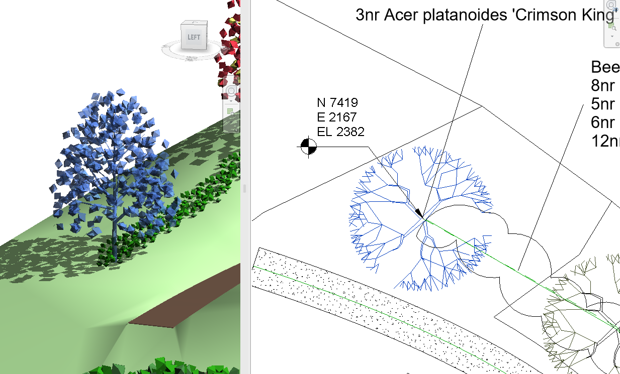
Client Request: Generate and display XYZ coordinates for every plant and tree
Diving deeper into client-driven developments in ArtisanRV and ArtisanCAD following last month’s Shadow Analysis blog, this month we are looking at one of our latest client-specific requests which is available in the latest updates.
CloudScapes First Responders
The CloudScapes development and technical teams have long-established user connections with architects, BIM specialists and landscape architect practices across the world. Something we’re very proud of is our first response to user requests: YES. Theoretically, of course, anything is possible and the beauty of a close-knit team who are both REVIT AND landscape-driven is that we can explore these user queries quickly, knowledgeably and realistically.
“Could CloudScapes tools automate, create and display XYZ Coordinates?”
Sparked by an initial request from an architect and REVIT specialist collaborator in the United States, Ricardo Torres Corza was looking for a way to automatically generate the XYZ coordinates of every plant, tree or element within a design in REVIT. This could be replicated in AutoCAD also. The customer wishlist in summary:
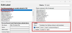
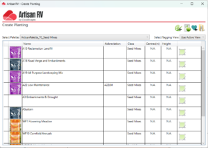
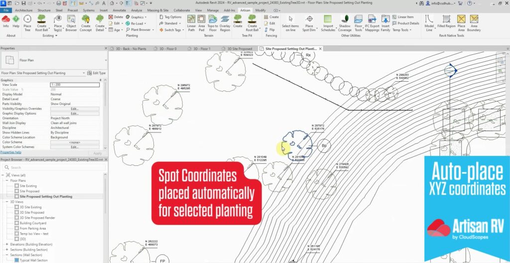
- Automate the generation of XY coordinates (also referred to as Eastings and Northings) for locating plants and elements as labels and display in drawings and schedules.
- XY Coordinates instantly shareable with contractors in setting-out drawings, removing the designer’s need to manually calculate and communicate these separately.
- Include these in the schedules.
- Output as a CSV to potentially be shared within LIDAR surveys and other location tools
- Useful to have? Z coordinate for height.
Developed and available to all users as standard
With parameters set, problem defined and potential solutions discussed, the CloudScapes platform allows the Development Team to swiftly manipulate existing data and/or import new datasets and prepare the best method to output and display this to fit the user brief. With this in mind, the user is always given a clear timeline of how and when a solution (or step towards one) will be delivered.
It is not just the original requesting user who benefits as these types of changes are then made available to ALL USERs dynamically via CloudScapes’ unique AutoUpdate service.
The CloudScapes cloud-based suite of tools are designed to make the data work hard so that the visual results and additional or improved functionality pays back handsomely – to all users.
A BIM tool for both designers and contractors
Exploring the tool’s potential and fine-tuning labelling, naming and export protocols to suit its wider use, CloudScapes also consult user forums and specialists for feedback as the development progresses to ensure any new functionality is inclusive and appropriate for the widest of user methods and practices.
The result? The new XYZ Generator Tool has been developed over just 9 weeks! Functionality will continue to be added to the newly rolled out tool for all users, including:
- Eastings and Northings for setting out built elements, plants, trees and components alongside existing site data.
- Height and Spot Coordinates for elevations to help users understand cut and fill requirements.
- Export to CSV/XLS for laser scanning and use in other topographical tools used to accurately local planting on site.
What could help YOUR planting plans?
How can we help you in REVIT, BricsCAD or AutoCAD?
Do you have something you would like us to develop within ArtisanRV, ArtisanCAD and BIM for landscape with REVIT, BricsCAD or AutoCAD? Get in touch with the CloudScapes team and let us take on the challenge for: better workflows; effective data sharing; smoother and more impactful models and visuals and the ultimate in BIM information exchange for better landscape design.
CloudScapes and Best Practice with the Landscape Institute
Tim Calnan, Managing Director of CloudScapes, has been working with the Landscape Institute on BIM collaborative projects, working groups and advisory panels for over 30 years.
Of particular relevance to this user request and CloudScapes ability to understand and develop solutions has been Tim’s consultative role in preparing the LI’s Technical Guidance Note 01/21 Best Practice for Sharing Projects in the UK and Ireland when Using BIM and CAD Software – Objects and Project Datum.
This concerns itself wholly within the sphere of XYZ coordinates – measured values from an object’s origin which exist in two and three dimension and position that object within the project and OS National Grid – and is critical in the accurate placement, reporting and setting out of planting plans for contractors and any other collaborators along the supply chain.
What are XYZ coordinates?
Within the UK, there is a National Grid origin (i.e. the bottom left-hand corner of the OS National Grid which has the coordinate 0,0) and within landscape designs there will be a project origin, which is typically an intersection of the OS National Grid near to the project site or some other easily identifiable point also near to the site.
In the UK, the project origin should be defined as a coordinate relative to the OS National Grid origin.
An origin is defined as a datum point for measured or calculated values either in the real world or CAD and BIM systems. These measured values from the origin are coordinates, which exist in three dimensions: XY in 2D and Z for height in 3D.